Max Elevation: 5,005m
Highest Camp: 4,220m
Standard: Medium-Hard
Season: April to June & Mid September to Mid Nov
Start: Drukgyel Dzong (Paro)
Finish: Tashitang (Punakha)
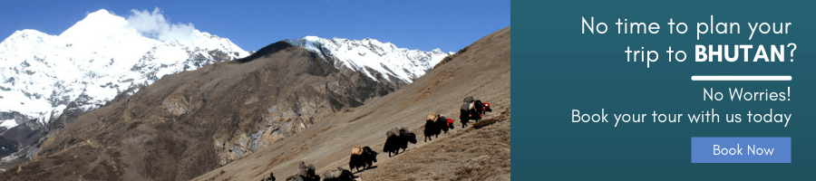
The first part of the Laya Gasa Trek goes along the same route as the Jomolari Trek I right till Lingshi. Besides the unforgettable views of Mount Jomolhari, the trek offers spectacular views on Jichu Drake, Gangchhenta (Great Tiger Mountain). Between Jangothang and Laya the trail hardly goes below 4,000m and one has good opportunities to spot blue sheep or even takin. Some beautiful Bhutanese mountain villages, the unique culture and appearance of the Layaps (people of Laya district) and finally a day of relaxation at the Gasa hot springs add to an extremely rewarding trekking experience.
All in all, the Laya Gasa Trek is considered to be the most beautiful trek of Bhutan, only to be beaten by the tough Snowman Trek.
Start: Drukgyel Dzong
End: Sharna Zampa
Walking Distance: 17 km
Walk Time: 4-5 hours
Ascent: 360m
Descent: 80m
Camp Altitude: 2,850m
Day 1 :Drive up to Drukgyel Dzong (2,580m) where the road ends and the trek begins. With a gradual climb the trail follows the Paro Chhu passing beautiful meadows, paddy fields and impressive farm houses. After about four hours you will reach the army post at Gunitsawa village.
At the army checkpost your trek permit (provided by your tour operator) will be checked and endorsed. The campsite is on the opposite side of the river, not far from Gunitsawa.
Start: Sharna Zampa
End: Thangthangkha
Walking Distance: 22 km
Walk Time: 7-8 hours
Ascent: 770m
Descent: 10m
Camp Altitude: 3,610m
Day 2 : On this long day, the trail continues with lots of small ups and downs. After going uphill through the river valley, you enter the Jigme Dorji National Park. The valley finally narrows gradually to a mere path which descends to a meadow where a camp will be set up.
From here, if weather permits, you will have the first great view of Mount Jomolhari.
Start: Thangthangkha
End: Jangothang
Walking Distance: 19 km
Walk Time: 5-6 hours
Ascent: 480m
Camp Altitude: 4,080m
Day 3 : If you did not see Mount Jomolhari last evening, you will have a great chance to get a great view this early morning. This morning the trek continues up the Paro Chhu valley which widens into patches of alpine meadow and scanty growths of forest. Cross an army outpost along the way and enjoy a spectacular view of high mountain ridges and snow-capped peaks.
Yaks and the herder’s homes become a regular feature of the landscape. Passing the villages Soe, Takethang and Dangochang is another asset on this day. Reaching Jangothang, one of the most beautiful campsites of the Himalayas, you will again have a spectacular view of Mount Jomolhari.
Start: Thangthangkha
End: Jangothang
Walking Distance: 19 km
Walk Time: 5-6 hours
Ascent: 480m
Camp Altitude: 4,080m
Day 4 : Jangothang Halt.
The day in Jangothang provides plenty of possibilities for day hikes with great views on lakes and snow capped mountains such as Jomolhari and Jichu Drake. There are good chances to spot some blue sheep on the upper slopes of the valley. Jangothang is a perfect environment for your acclimatisation. Trek up to Tosoh or hike around the area.
There are good short hiking trails in three directions. Jomolhari and it’s subsidiary mountain chains lie directly west, Jichu Drake to the north and a number of unclimbed peaks to the east.
Start: Jangothang
End: Lingshi
Walking Distance: 18 km
Walk Time: 6-7 hours
Ascent: 840m
Descent: 870m
Camp Altitude: 4,010m
Day 5 : After 15 min. from the camp the trail climbs rapidly for about half an hour and then becomes a gradual ascend to the Nyilila pass at 4,870m. While on the climb enjoy the surrounding. You might see herds of blue sheep grazing on the slopes of the mountains. From the pass you will have spectacular views of Mt. Jomolhari, Jichu Drake and Tsherimgang, all of them rising above 7,000m. On the way down to the camp you will pass by some of the yak herder’s tent, made from yak wool, where the herders take shelter while on the move to various pastures for their yaks.
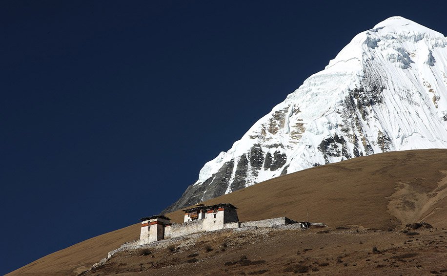
As you come down into the Lingshi basin, you get a wonderful view of Lingshi Dzong on a clear day. Tserimgang and its glaciers rise up at the north end of the valley. The campsite is next to a stone hut you reach just before Lingshi Dzong.

Start: Lingshi
End: Chebisa
Walking Distance: 10 km
Walk Time: 5-6 hours
Ascent: 280m
Descent: 410m
Camp Altitude: 3,880m
Day 6 : Today is the shortest walking day, and you can really take it easy. Shortly after starting you will reach a chorten below Lingshi Dzong. Here, you have the choice of staying on the main trail or taking a diversion up to the Lingshi Dzong (4,220m), which sits right atop a ridge. Besides a very special atmosphere of mystic silence Lingshi Dzong provides a great view over the valley. After Lingshi Dzong you will be passing the villages of Lingshi and Goyul.
In Goyul, the stone houses are clustered together to a small compact village that is unusual in Bhutan where village houses are normally scattered. On reaching the campsite at Chebisa with a beautiful waterfall behind the village, you will have plenty of time to visit the village houses if you feel up to it.
Start: Chebisa
End: Shomuthang
Walking Distance: 17 km
Walk Time: 6-7 hours
Ascent: 890m
Descent: 540m
Camp Altitude: 4,220m
Day 7 : You walk through a wide pastureland towards Gobu La (pass). On the way, you will see a few people herding yaks. There is also a great chance to spot large herds of blue sheep above the trail. After crossing the Gobu La (4,410m), you descend to the valley, then climb again a little bit, and descend again to Shakshepasa (3,980) where a helipad has been established. Climbing from here you will finally reach the campsite at Shomuthang, above a river, which is a tributary of the Nochu River.
Start: Shomuthang
End: Robluthang
Walking Distance: 18 km
Walk Time: 6-7 hours
Ascent: 700m
Descent: 760m
Camp Altitude: 4,160m
Day 8 : As the walk is a little strenuous, it is advisable to start early with climbing up the valley to view Kang Bum (6,526 m) and some edelweiss. After two hours of climbing you will reach Jhari La (4,750m), from where you catch the first sight of Sinche La, the pass you will have to cross the day after. The big snow peak in the north is Gangchhenta 6,840 m, better known as the Great Tiger Mountain. If weather is clear, Tserim Kang and the top of Jomolhari will be visible.
The camp by the river is called Tsheri Jathang. Herds of takin, the Bhutanese National Animal, migrate to this valley in summer and remain for about four months. The valley has been declared a takin sanctuary. Climb up a little bit and you will reach the campsite at Robluthang in a rocky meadow.
Start: Robluthang
End: Limithang
Walking Distance: 19 km
Walk Time: 6-7 hours
Ascent: 850m
Descent: 870m
Camp Altitude: 4,140m
Day 9 :After crossing Sinche La (5,005m) – the last and highest pass on the trek in case you don’t intend to continue the Snowman trek from Laya onwards – you descend to a little stone house where a few Laya women – dressed in typical Laya costume with long pointed bamboo hats on their head – live and offer their weaving products. Right behind the stone house you will see an impressive terminal moraine and a glacial lake at the foot of the valley.
You can see classic examples of the lateral moraines where the glacier has pushed rocks up both sides of the valley. Below the moraine, you cross the Kango Chhu and soon reach the Limithang campsite. The peak of Gangchhenta towers over the campsite even though it’s quite a distance away.
Start: Limithang
End: Laya
Walking Distance: 10 km
Walk Time: 4-5 hours
Ascent: 60m
Descent: 340m
Camp Altitude: 3,840m
Day 10 :Today, you walk all the way downhill along a narrow winding river valley. After a long time, you again trek partly through deep forest. The trail leads you to the west side of Laya village.
From the west of the village you will view Gangchhenta again and catch a glimpse of Masagang. In the village centre is a community school and a basic health unit with telephone connection. The campsite is below the school.
Start: Laya
End: Koina
Walking Distance: 19 km
Walk Time: 6-7 hours
Ascent: 260m
Descent: 1,070m
Camp Altitude: 3,050m
Day 11 : The trail winds up and down along the river valley of Mo Chhu avoiding natural obstacles and affording breath-taking views of the crashing river, feeder streams and water falls. Lots of ups and downs will lead you to Kohi Lapcha at 3.300 m. The trek then drops down to the large stream of Koina Chhu, where you will find the campsite of Koina.
Start: Koina
End: Gasa
Walking Distance: 14 km
Walk Time: 6-7 hours
Ascent: 740m
Descent: 1,500m
Camp Altitude: 2,240m
Day 12 : Today you will have your last major climb of the Laya Gasa Trek. You will cross the Bari La (3,740m), after which the trail is all the way down till you reach Gasa village (2,770m), where you will find the first restaurants since starting from Drukgyel Dzong.
There also is a campsite close to Gasa Dzong (. You will have to decide if you want to stay in Gasa village or descend for another one hourto the Gasa Tsachu (hot springs) and relax in the thermal water. The Gasa Tsachu is one of the most popular hot springs in Bhutan.
Start: Gasa
End: Damji
Walking Distance: 18 km
Walk Time: 5-6 hours
Ascent: 480m
Descent: 470m
Camp Altitude: 2,250m
Day 13 :After a short climb, the trail winds through lots of ups and downs, through rolling hills and passes and pine and oak forests, villages and wheat fields. You will also see a beautiful view of the Gasa Dzong glued to the valley wall as if floating in space. You finally reach Damji with its well-maintained campsite.
Start: Damji
End: Tashithang
Walking Distance: 16 km
Walk Time: 5 hours
Ascent: 250m
Descent: 870m
Day 14 : The trail descends from the high agricultural benches above the Mo Chhu into a lush semi-tropical gorge filled with banana trees, creepers and various tropical vegetation. You will also see monkeys and a few other animals occasionally. The road actually leads further up than Tashithang and will soon reach Damji.
You can save about two hours of walking when you arrange transport from the current road head.